Overview
A map element displays a fully interactive native Apple map. Users can navigate the globe through the map and mark special locations with customizable pins.Pins
Click the pin icon in the map’s context bar to add map pins. Click anywhere on the pop-up to add a pin. Repeat this process to add any number of pins. Delete a pin by right-clicking it in the pin list. The iOS Pin Editor is still in development.Edit All Pins
Enable to change all pin colors + content at once.Type
- Default: Automatically generated number labels.
- Label: Type a custom pin label.
- SF Symbol: Use SF Symbols for selected and unselected pins.
- Custom Icon: Use uploaded PNGs for selected and unselected pins.
Pin Tint
Set the pin background color.Content Tint
Set the pin’s foreground content color.Properties
In addition to the properties below, glass effect containers also have access to general object properties in the Expression Editor.
Start Location
Set the start location of the map when it loads:- User: The map will load on the user’s location.
- Pin: The map will load on a selected pin.
- Custom: The map will load in a custom location.
- User
- Pin
- Custom
Location Accuracy
Set how accurate the start location is based on the user’s actual coordinates (only for User start location):- Best: Standard accuracy.
- Navigation: Extremely high accuracy.
- Reduced: Low accuracy.
In Expression Editor
In Expression Editor
numberValues:
-90 - 90Can get the user’s latitudinal location.
numberValues:
0 - 360Can get the user’s longitudinal location.
Altitude
Set the map’s starting altitude (distance from earth) in meters.In Expression Editor
In Expression Editor
numberCan get or set the value.
Animate
Choose if the map should animate to the start location.Type
Set the map’s type to Standard, Satellite, or Hybrid.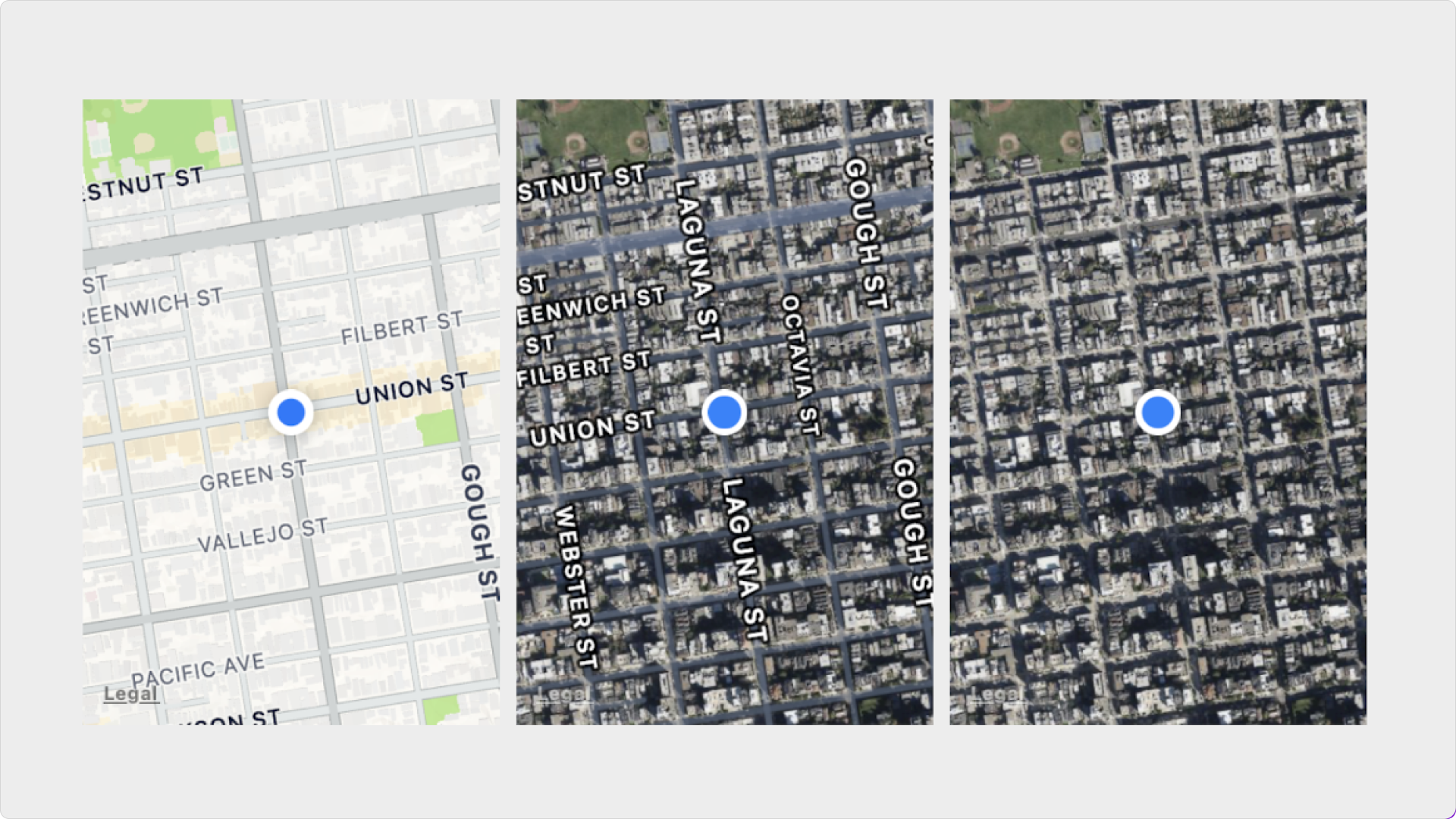
Pin Selection
Customize the map’s behavior when a pin is selected:- Move to Pin: Choose if the map will move to a selected pin’s location.
- Altitude: Set the map’s altitude when a pin is selected.
- Offset X & Y: Set the selected pin’s X & Y offset from the map’s center.
Other Settings
Customize other settings for a map, by turning Auto off:- Show Compass (Only visible while rotating the map)
- Show Scale (Only visible while pinching the map)
- Show Points of Interest
- Show Buildings
- Show Traffic
- Pan
- Zoom
- Rotate